PLEASE
BE PATIENT WHILE IMAGES LOAD
French Sector
Berlin's French Sector
receives extremely short shrift in this
photo-essay, and what little material has
found its way here is not particularly
pleasant. It is not that I intend to
slight the neighborhoods and nationalities
concerned; it is only that I rarely had
occasion to visit the French Sector, other
than to dine at the French military
restaurant or catch a plane. Still,
there is material of interest, even if only
to present a Cold-War base-line by which to
gauge progress since.
|
|
| Reinickendorf |
Flugplatz Tegel
So far as I am aware, Reinickendorf's main
point of interest is Tegel Airport, which serves
as both a commercial terminal and an allied
(French) air base. Situated on the northern
outskirts of the city, it is rather out of the
way, but it is the only airfield in West Berlin
with runways and clearances sufficient to
accommodate large commercial jetliners—a
category represented at the time mainly by the
DeHavilland Comet, the Boeing 707, and the
Douglas DC-8. (I'm sure I have a photo of
one of these birds on the runway; I'll put it up if and
when I find it.)
(It is my understanding that
Tegel was not used for the Berlin Airlift in
1948-49, though the reason is not clear.
The newest of West Berlin's three airports,
perhaps it had not yet been built.)
|
|
| Wedding |
|
 |
◄
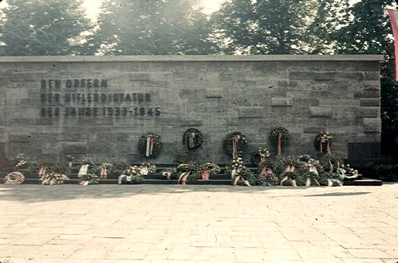
Denkmal Plötzensee
This out-of-the-way memorial is dedicated to the
victims of the Hitler regime.
|
|
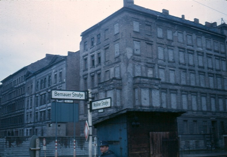 |
◄ Bernauer Strasse
Bernauer Street has the dubious
distinction that the street and sidewalk are in
the French sector, while the buildings along it
are in Soviet territory. As the Wall
(visible at lower left) was being built in August
1961, many who lived in these apartments
frantically jumped from their windows to the
sidewalk below, before the buildings were
fully evacuated and their windows bricked up.
West Berlin firefighters
brought in nets, but some jumpers missed them in
their panic. It says something about a
government when its people fear it as much as a
fire in their homes.
|
Wedding was the
western terminus of one of the first refugee tunnels dug
underneath the Berlin Wall. It extended from the basement of an
abandoned factory on Schönholzer Strasse in the
Soviet sector, underneath Bernauer Strasse to
another building in the French Sector. Though
marvelously well constructed and its secrecy
maintained, the tunnel was plagued by water from
leaking pipes, and had to be shut down after only
a few days of operation.
|
|
|
PLEASE
BE PATIENT WHILE IMAGES LOAD
Soviet Sector
The Soviet Sector is the largest of the
four, and, to be sure, only a small proportion of
it is devoted to the Wall and its death
strip. There are many things of interest in
East Berlin, even some of great beauty, such as
might be found at Museeninsel (Museum
Island). But while it is permissible for
most allied personnel to visit the East, my
association with intelligence operations
precludes my crossing into either East Berlin or
East Germany, except by "secure
transport"—which means a military duty
train, an air force transport, or on an American
airliner. And even were I permitted to go
there, my camera would not be. No casual
stroll along Unter den Linden for me! And
so the only photos that appear here are what I
can take from the Western side.
|
|
| Die Mauer |
|
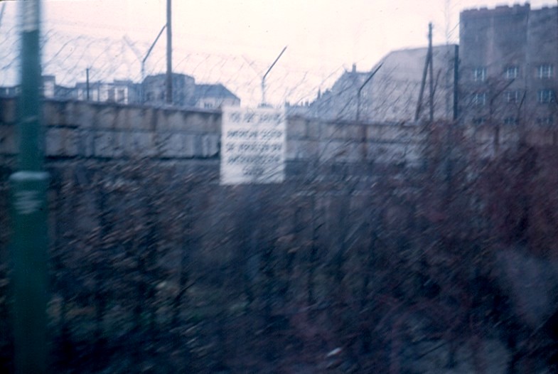 |
◄ The Wall
The 43-kilometer-long Wall
emphatically marks the border between East and
West Berlin. It slashes brutally through
neighborhoods, across streets and tracks.
Polyglot signs warn, "You are entering the
Soviet Sector." Right—with a
ladder, wire cutters, and a death wish, maybe!
|
|
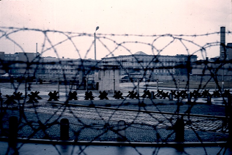 |
◄ Death Strip
To discourage would-be refugees
from approaching the Wall, an area along the Soviet side
contains anti-personnel mines, vehicle
barricades, attack dogs, and machine guns
actuated by trip wires, in addition to watch
towers manned by armed guards.
|
The external borders of West
Berlin—those facing the East German state
rather than East Berlin—are likewise
barricaded by a 110-kilometer fence—long
enough to stretch more than half-way to West
Germany!
Although the building of the wall is
roundly deplored and condemned, some in the West note (under
their breath) that it actually has a couple of significant
benefits. First, it stops a mass immigration of labor to
the West, which would otherwise eventually have the effect
of driving wages down and prices up (as will indeed happen
following reunification). And second, it offers Western leaders a propaganda windfall, as a
demonstration of the wholesale failure of Communism at the
popular level.
|
|
Mitte
|
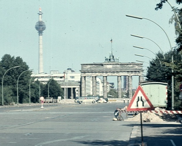
▲ Brandenburger
Tor
|
East-West Axis:
Unter den Linden -
Straße des 17.Juni |
Perhaps the most
famous landmark in all Berlin (aside from the
Wall), Brandenburg Gate is the only major point
of interest in the Stadtmitte (central city) that
I can approach closely enough to
photograph. The cast-bronze quadriga atop
the Gate is a Russian replacement of the
original, which was destroyed during the war.
Brandenburg Gate
is situated just inside the Soviet Sector at the eastern end of Tiergarten
in the British Sector. Viewed here
from Strasse des 17. Juni, the Wall
slices across Berlin's proud East-West Axis
boulevard just in front of the Gate, as if cutting the city's throat.
Beyond, the street becomes Unter den Linden as it
passes through the Gate and onward into the
central city. Standing to the left and under construction
is East Berlin's new television broadcast tower.
Once its
smooth outer skin has been installed, the broadcast tower will unexpectedly delight
many by reflecting the rays of the sun in the pattern of a
four-pointed star or cross. Hardly a miracle, mind you,
just a familiar reflective effect of curved
surfaces—but it will become known as "Saint Walter's Cross," to
the dismay of its namesake, East German Chancellor Walter Ulbricht.
|
|
|